
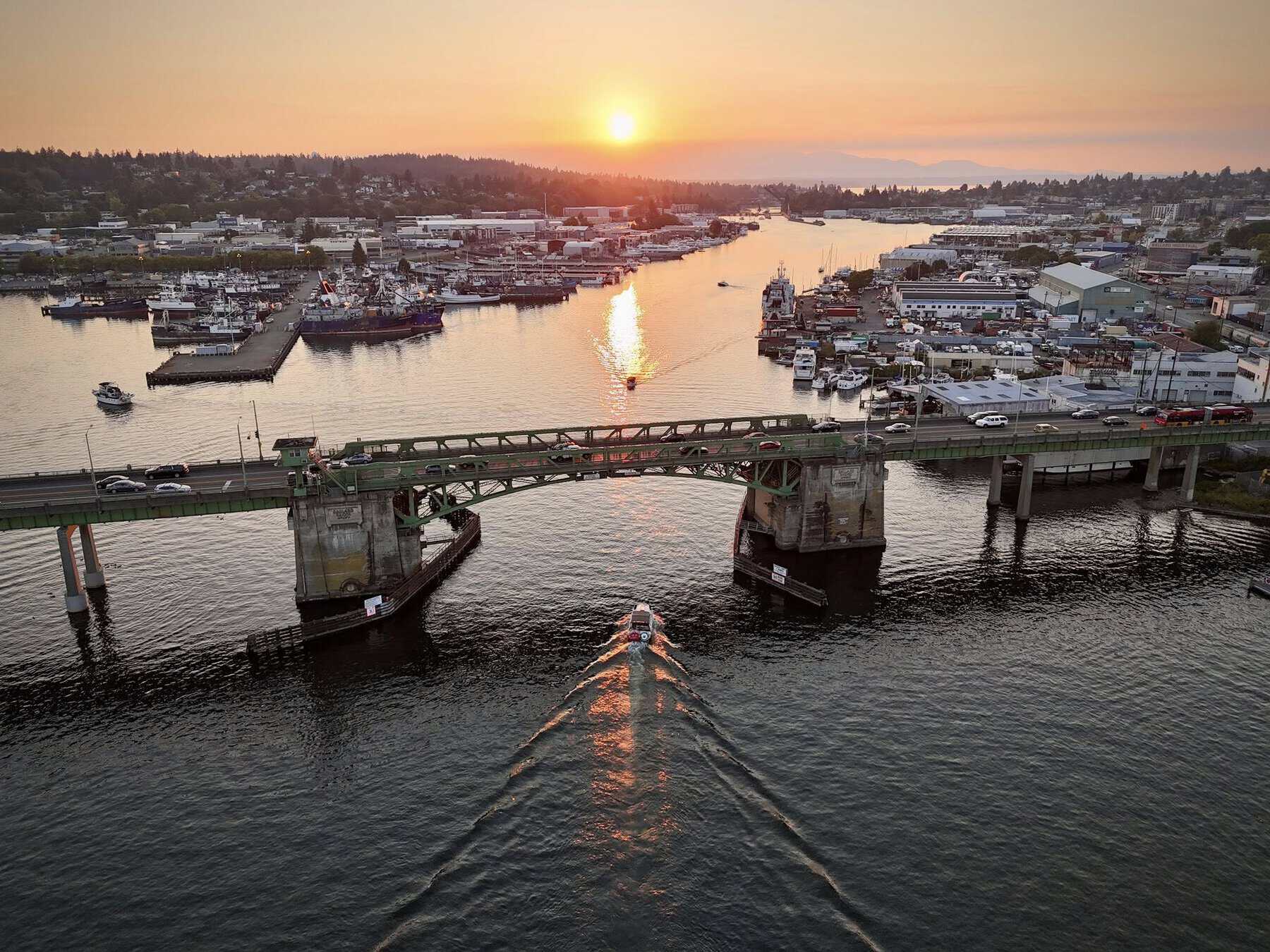
Originally opened in 1917, the Ballard Bridge is one of Seattle’s most iconic and essential pieces of infrastructure. Spanning 2,854 feet across the Lake Washington Ship Canal, this historic bascule bridge (or drawbridge) serves as a vital arterial connecting the Ballard neighborhood with Interbay, Magnolia, Queen Anne, and Downtown Seattle.
Whether you are driving, cycling, walking, or boating underneath, navigating the bridge is a daily reality for thousands of Seattleites. Here is a complete guide to its history, openings, and essential tips for commuters.
Bridge Specifications and Architecture
- Type: Double-leaf bascule bridge (drawbridge).
- Total Length: 2,854 feet.
- Waterway Clearance: Offers 44 feet of vertical clearance for maritime traffic when closed.
- Historical Significance: The bridge opened for traffic in late 1917 and is officially recognized as a historic landmark, embodying Ballard’s deeply rooted maritime, fishing, and industrial legacy.
Understanding the Bridge Openings
Because the Ship Canal connects the saltwater of Puget Sound (via the Hiram M. Chittenden Locks) to the freshwater of Lake Union and Lake Washington, the Ballard Bridge opens frequently throughout the day to allow tall vessels, sailboats, and commercial fishing fleets to pass.
How Long Does an Opening Take?
On average, a standard bridge opening takes about 4 minutes from the moment the traffic gates lower to the time they rise again. However, if a large flotilla or a slow-moving commercial vessel is passing through, openings can occasionally last longer.
Weekday Commuter Restrictions
To keep vehicle traffic moving during peak rush hours, the Seattle Department of Transportation (SDOT) enforces strict closure exemptions. The bridge will not open for marine vessels during the following times on weekdays:
- Morning Peak: 7:00 AM – 9:00 AM (Monday through Friday)
- Evening Peak: 4:00 PM – 6:00 PM (Monday through Friday)
Exemption: The bridge operator will still open the bridge during these hours for commercial vessels weighing 1,000 gross tons or more.
Tips for Drivers and Commuters
- Check Traffic Before You Head Out
Because a sudden opening outside of rush hour can quickly back up traffic along 15th Ave NW, checking local traffic maps or the SDOT Twitter/X feed before your commute is always a smart move. - Look for the Warning Lights
As you approach the bridge from either the north (Ballard) or south (Interbay) side, keep an eye out for the yellow flashing overhead signs. If they are flashing, it means a bridge opening is imminent, giving you time to safely slow down or choose an alternate route (such as the Fremont Bridge or Aurora Avenue) - Enjoy the View
If you do get caught in an opening, take a moment to look out your window! Looking west offers a beautiful view of Salmon Bay, the historic Fishermen’s Terminal, and the Ballard waterfront.
The Ballard Bridge Public Art
Next time you traverse the north end of the bridge, keep an eye out for the local artwork integrated into the infrastructure. Near the approach, you’ll find eight distinct 10-foot-tall aluminum sculptures. Designed by artists Tom Askman and Lea Anne Lake, these public art pieces were installed to honor and reflect Ballard’s rich Scandinavian heritage and Native American roots.
Resources for Boaters
If you are operating a vessel that requires a drawbridge opening, you must signal the bridge operator ahead of time. Boaters can contact the Ballard Bridge tower directly via VHF Marine Channel 13 or by sounding a whistle signal (one long blast followed by one short blast).
For comprehensive maritime rules and standard operating guidelines, you can view the city’s official maritime policies here:
👉 View SDOT’s Official Bridge Opening Procedures and Marine Rules